
St. Maarten / St. Martin


![]() This section reflects St. Maarten / St. Martin as it was during my six visits from 2005 through 2013. This part-Dutch and part-French island at the top of the Leeward Islands was my Caribbean winter break destination during those years, and I was so impressed by its natural beauty and by the wide range of activities offered that I kept coming back.
This section reflects St. Maarten / St. Martin as it was during my six visits from 2005 through 2013. This part-Dutch and part-French island at the top of the Leeward Islands was my Caribbean winter break destination during those years, and I was so impressed by its natural beauty and by the wide range of activities offered that I kept coming back.
Hurricane Irma in September 2017 devasted the island. It was the the strongest storm on record in the open Atlantic, and the first Category 5 hurricane to strike the Leeward Islands. Four people were killed, about 75 severely injured, power and communications were wiped out, and two-thirds of the buildings were left uninhabitable, including the airport terminal. The recovery is now largely complete, but signs of the devastation are everywhere.
![]() Here are photos from my 2005-2013 visits, organized by location and activity. For those of us lucky enough to have seen SXM before the storm these images can bring back memories. For others these are a preview of what's to come.
Here are photos from my 2005-2013 visits, organized by location and activity. For those of us lucky enough to have seen SXM before the storm these images can bring back memories. For others these are a preview of what's to come.
The link to the Pictures File is below the Sample Images. A Route Map and a Table of Contents are provided below that, both in on-screen and printable forms.
Quick Start: St-Maarten.pdf
Top Sample Images Link to Pictures File Maps Contents Bottom
Sample Images
Here are a few sample images from the picture files. You can click or tap on these to see larger versions.

Simpson Bay Lagoon

Marigot

Oyster Pond

Orient Beach

Baie d'Embouchure

Aboard Golden Eagle

Aboard Lord Sheffield

12 Metre Challenge
Top Sample Images Link to Pictures File Maps Contents Bottom
Link to Pictures File
You can access the PDF pictures file by clicking or tapping on the link below.
| File | Pages | Size |
|---|---|---|
| St-Maarten.pdf | 188 | 32.3 MB |
Top Sample Images Link to Pictures File Maps Contents Bottom
Maps
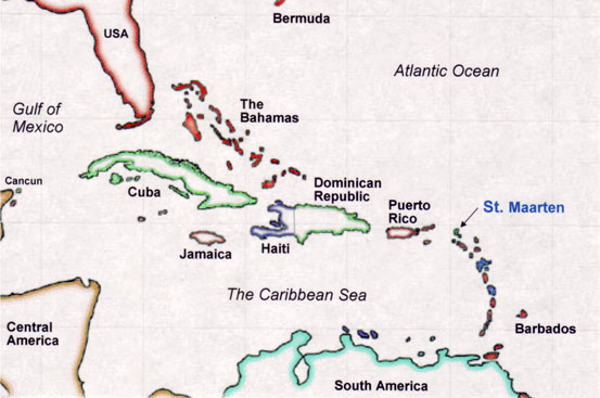
St. Maarten is located at the top of the chain of Leeward Islands in the north-eastern Caribbean. A map of the island appears below the locator map.
A package of printable maps is available if you wish paper copies to follow along. St. Maarten Maps includes the two maps shown below and a highways map.

Top Sample Images Link to Pictures File Maps Contents Bottom
Table of Contents
The Contents table from the pictures file is reproduced below. If you wish a paper copy to target your viewing, use St. Maarten Printable Contents .
| St-Maarten.pdf | |
| Contents | 2 |
| Introduction | |
| Locator Map | 3 |
| St. Maarten Map | 4 |
| Introduction | 5 |
| Capitals | |
| Philipsburg | 8 |
| Marigot | 20 |
| West | |
| Simpson Bay Lagoon | 27 |
| Port de Plaisance | 30 |
| Megayachts | 44 |
| East | |
| Oyster Pond | 50 |
| Captain Oliver’s | 54 |
| Pelicans | 64 |
| Orient Bay | 71 |
| Orient Beach | 75 |
| Beach Activities | 81 |
| Baie d’Embouchure | 92 |
| Activities | |
| Lord Sheffield | 98 |
| 12 Metre Challenge | 104 |
| Golden Eagle | 108 |
| Lambada Anguilla | 119 |
| ATV Experience | 122 |
| Seaworld Explorer | 124 |
| Visits | |
| Butterfly Farm | 127 |
| St. Maarten Park | 134 |
| Mont Vernon | 138 |
| The Economy | |
| Industry | 146 |
| Development | 152 |
| Third World | 163 |
| Sunsets | 179 |
| End | 188 |
Top Sample Images Link to Pictures File Maps Contents Bottom